
Nan
-
Posts
1810 -
Joined
-
Last visited
-
Days Won
10
Content Type
Profiles
Forums
Events
Blogs
Gallery
Everything posted by Nan
-
Happy Birthday Stormy, have a lovely day ! 😃🍺🎉🎉
-
I guess when it snows you will be able to follow the footsteps to find her .. I hope her little paws don't get too cold Koach, she might need socks
-
Wow the double one looks complicated ! Now you need to record while playing, then post it so we can listen
-
Happy Birthday from me also, SolidSnake !! Hope you're having a fantastic day !!
-
They aren't available to view
-
I recognise eggs (they look like poached eggs?) but no idea what the other food is lol
-
Yum they look delicious !!
-
It's amazing how they only attack tourists .. I feel so safe when I walk under trees lol
-
LOL !!!!!
-
LOL !!!!!
-
???
-
Koach that's how our forefathers made it to the countries where we all live today. I think I prefer something a bit bigger and sturdier.
-
LOL Koach I'll see what I can do, I couldn't see my house in the photo, it's up hidden in the mountains. Maybe I'll ask those people to hover over our town and take a photo so I can share it. The closest I can get you, is if you turn it around until you can see a mountain in the distance with cloud over the top (so you can't quite see the peak) that is Mount Bellenden Kerr, the highest mountain in the State. I'm pretty much directly behind that mountain on the other side of the plateau. The mountain range is the far northern end of the Great Dividing Range which runs a lot of the way along the east coast of Australia from south to north
-
I saw a photo from a Facebook page called Lensaloft Photography and I thought I'd share it as it's a 360 degree aerial shot of Cairns in Far North Queensland. If you move the photo around to the west towards the mountains, that is where I live. http://tinyurl.com/yygkp98a - hope the link works for you The link to the Facebook page is https://www.facebook.com/Lensaloft/ there are loads of really great aerial shots of various cities around the world.
-
Beautiful sunset .. I notice that Airforce 1 was passing overhead ?
-
Great photos of the Tall Ships. I remember when they sailed into Sydney Harbour as part of the bi-centenial celebrations, it was a great sight. My parents then lived in a house built on the side of a cliff overlooking the harbour and we were lucky to be on leave from New Guinea. We all sat on their patio and sipped champagne (I think the guys drank beer) and watched the parade of ships.
-
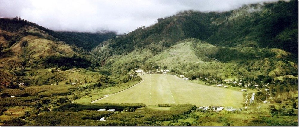
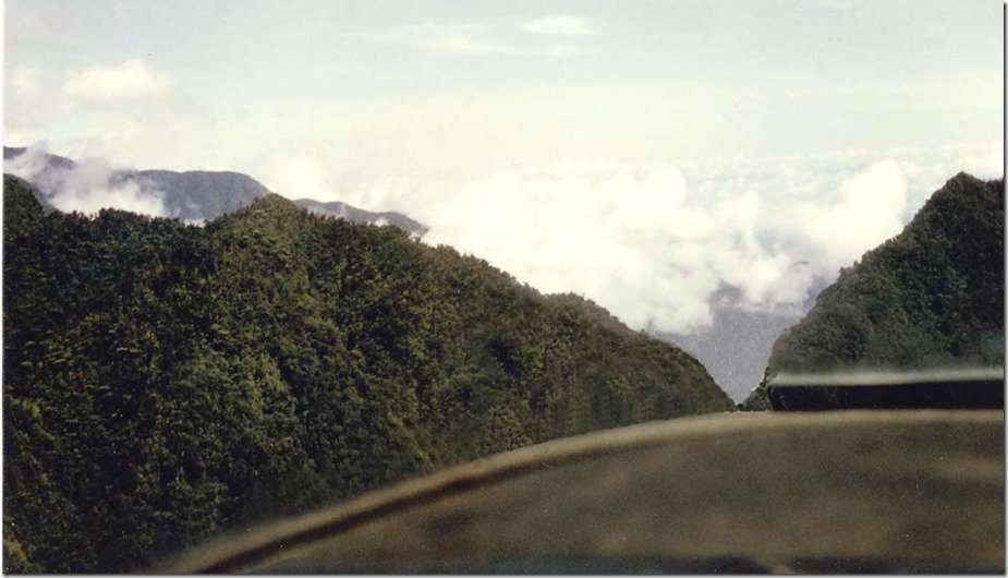
Koach that gap is the one we all flew through to get home to Goroka where we were living in the 70s and 80s .. if the gap was clouded in, the planes turned back. They say that if a pilot has flown and survived in Papua New Guinea, they can fly anywhere in the world. There is one airport that was, at one time, the busiest airport in the world, due to the discovery of gold and the flights in and out with equipment. Some say it was Wau (the strip in the top photo) but I believe it was a different one but still in the same timeframe. With mineral discoveries and wars and the only way to get around New Guinea being by air, there's a lot of flying in often hazardous conditions.
-
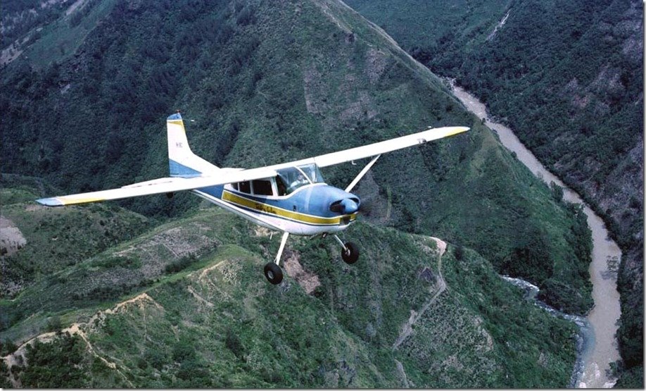
We all stay away from the Kukukukus .. they are a very short race and very fierce .. they are fantastic security guards too My favourite photo is the second one of the pilot looking up to the aircraft with the cameraman on board. I love the detail and the river down below, very typical of what we saw when we were flying to and from in PNG
-
LOL yes Koach !!
-
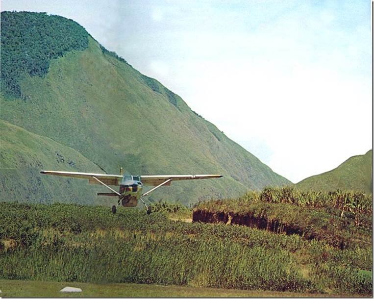
I was sent some really interesting photos today taken in the 60s of flying in Papua New Guinea. They say that a pilot is not a pilot unless they've flown and survived in PNG. I thought I'd share one or two and the information about each photo Hopefully they will appear in the correct order : Photo 1 - The famous Wau airstrip. 1966. This airfield was built by gold mining pioneer Cecil Levien in 1927. The first landing was by “Pard” Mustar in a de Havilland 37 belonging to Guinea Gold Airways, Lae. Shortly thereafter many aircraft types, including the giant Junkers G-31 tri-motors were landing huge loads at Wau in support of the mining operation here and up at Edie Creek (centre above the cloud base). At 3475 feet above sea level and with almost a 10% slope, it was an ideal New Guinea airfield. During January 1942, Japanese forces from Salamaua and via the Black Cat Gap attacked Wau and were defeated by the Australian Kanga Force. The Japs got to the bottom boundary of the drome and Australian soldiers, landing in DC-3s with artillery, pushed them back. Photo 2 - Talair C/185 VH-GKC near Omkalai. 1966. That’s the Wahgi River down below. Photo 3 - The Asaloka Gap- near Goroka- 1966. A minimum altitude of 7600 feet was advisable to comfortably get through, using correct New Guinea bush flying technique. Always use the oblique approach when crossing a gap. With a downdraught, engine failure or misjudgment you can more easily turn away, a shallow turn rather than a full 180 degree turn. Such gaps, when almost clouded in (imagine only the sharp V being open here) could be very tempting to try to fly through. Many fatal crashes happened because pilots took the chance. There are some big mountains around here, nearby Mt Wilhelm is 14,793 feet high. Photo 4 - Rough country. Cessna 185 landing at Marawaka. Like Wonenara, it is the land of the Kukukukus. The most feared tribes in New Guinea. Wonenara airstrip. North of Marawaka and north of the Kratke Range. Poison arrow country.
-
I saw this today and thought I would share. In Australia many words end in "o" .. see below: The well earned work break is the smoko Household rubbish is taken by the garbo We fill our cars with petrol from the servo When it is the afternoon, that is the arvo People in an ugly mood are being aggro A typographical error is known as a typo Time off with a work injury, is the compo Cost-effective wine, is drunk by the wino The unfortunate down and out is a derro The Ambulance Paramedic, is the Ambo Home delivered milk is done by the milko Upgrading the home is also giving a reno The name for the liquor store is a bottle-o Our car registration that's due is the rego The newspaper journalist is also a journo And good charity work is done by a Salvo The leader of the Opposition Party is Albo The Prime Minister of Australia, is ScoMo
-
Looks like a shelf cloud - they form at the start of storms, sometimes strong thunderstorms
-
LOL !!!!!!!!!
-
???
-
R.I.P Gizmo ... silip isi xx